 SnapshotChecking image…
The Colorado webcam guide
Powerhorn Ski Resort and Skyway Ski Trail
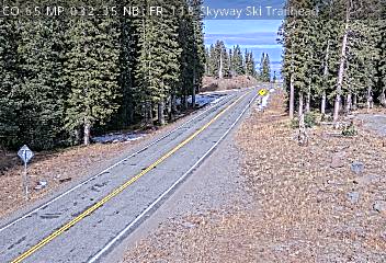
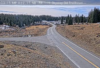
3 camera views · Snapshots refresh every 60 seconds while visible.
SnapshotChecking image…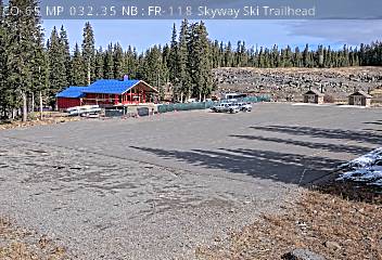 SnapshotChecking image…
 SnapshotChecking image…
CO-65 FR-118 Skyway Ski Trailhead: by Parking Lot (looking south)
Source: cocam.carsprogram.org
Feed status reflects a migration-time image request, not a guarantee that the image is current. Check the image timestamp. Camera imagery © the credited provider.
About Powerhorn Ski Resort and Skyway Ski Trail
The Skyway Trail System is located on Highway 65 approximately 10 miles south from the turnoff to Powderhorn Ski area. Skyway offers pristine skate skiing and many challenging routes. All trails are groomed for both classic and skate skiing. Skyway warming hut is located just 100 yards from the trailhead. Skyway is connected to County Line via two trails, Scales Lake and Kannah Crossing. The network features various loops that combine for about 12 miles (19.6 kilometers) of groomed trails. Connected with the adjacent County Line system, skiers can access a combined total of over 19 miles (30 kilometers) of cross-country routes.
Powderhorn Mountain Resort is located 45 minutes east of Grand Junction, Colorado on the Grand Mesa. The ski area is more a place for families, beginner and intermediate skiers, than for more advanced skiers, but it does have a few steeper tree runs and boulder fields full of jumps and cliffs. Sitting at 8,200 feet (2,500 meters) alongside the northern edge of Western Colorado’s beautiful Grand Mesa - the world’s largest flattop mountain, the ski area offers breathtaking views and over 1,600 acres (648 hectares) of mountain terrain. Powderhorn’s location provides over 250 inches (636 cm) of light powder snow each year, and 70% of the runs are beginner or intermediate and excellent for snowboarding. During the summer months, Powderhorn offers lift-access hiking and downhill mountain biking on 15 miles of purpose-built trails.
Camera credits & local resources
Powerhorn Ski Resort and Skyway Ski Trail on the map
Location from the original Keno map embed; it marks the destination, not each camera.
Keep exploring
Original Keno page · Original descriptions © Keno Internet Services.