 SnapshotChecking image…
The Colorado webcam guide
Independence Pass
2 camera views · Snapshots refresh every 60 seconds while visible.
SnapshotChecking image…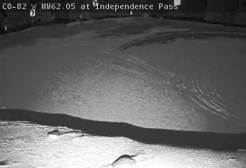 SnapshotChecking image…
Feed status reflects a migration-time image request, not a guarantee that the image is current. Check the image timestamp. Camera imagery © the credited provider.
About Independence Pass
These first 2 photos/text were put here since the actual live cams were taken down by CDOT and not returned for years
Below is one of the old cam shots from the pass, and also a still photo of the heavy snow on the pass, both have been added to this page to remind you how wonderful and beautiful the cams once were and what it looks like in case you never been on this pass before. Believe me, if you like mountain views, this is a beautiful drive and it has a very short trail on the top of the pass that leads to a great overlook of the mountains. The first shot is a summer view and the second one was a still shot taken in the spring while the road was being cleared of snow so it could be ready to reopen for the season:
Independence Pass (aka Indy Pass) is located in central Colorado, sitting at an elevation of 12,095 feet (3,687 meters) on the Continental Divide of the Americas. Colorado Highway 82 traverses it. This road is the highest in elevation for a paved Colorado state highway that sits on a through road. It’s also the fourth-highest paved road in the state, and is also the highest paved crossing of the Continental Divide in the U.S. Because of the heavy snows that fall on the pass, the road is closed in the wintertime. Originally known as Hunter Pass, Indy Pass is in the Sawatch Range of the Rocky Mountains. The pass is midway between Aspen and Twin Lakes, on the border between Pitkin and Lake counties. When the pass is open in warmer weather, it is a popular destination. A scenic overlook on the top of the pass allows visitors to take in the alpine tundra above treeline, and offers excellent views to the east of Mount Elbert, Colorado’s highest peak and the second-highest mountain in the contiguous United States. Independence Pass has a subarctic climate. It’s weather station sits about 2,000 feet lower than the pass. but going by its records, this area experiences a large amount of snowfall, receiving an average of 336 inches (854 cm) each snow season. Its warmest temperature ever was 81°F (27°C), set in July, while its coldest reading was set in January at -36°F (-38°C).
Camera credits & local resources
Independence Pass on the map
Location from the original Keno map embed; it marks the destination, not each camera.
Keep exploring
Original Keno page · Original descriptions © Keno Internet Services.