 SnapshotChecking image…
The Colorado webcam guide
Berthoud Pass
7 camera views · Snapshots refresh every 60 seconds while visible.
SnapshotChecking image…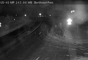 SnapshotChecking image…
 SnapshotChecking image…
 SnapshotChecking image…
 SnapshotChecking image…
 SnapshotChecking image…
 SnapshotChecking image…
Feed status reflects a migration-time image request, not a guarantee that the image is current. Check the image timestamp. Camera imagery © the credited provider.
About Berthoud Pass
Berthoud Pass (pronounced “BURTH-əd”) is a high mountain pass in central Colorado, with an elevation of 11,307 feet (3,446 meters). The pass is located west of Denver, and traverses the continental divide at the Front Range, on the border between Clear Creek County and Grand County. U.S. Highway 40 runs over this pass and it is a destination for local backcountry skiers, snowboarders, and snowshoers with its steep and challenging terrain and plentiful snow.
The pass is one of the most notoriously difficult passes in Colorado for motorists, based on its height as well as the steep grades (at 6.3%) on both sides and the large number of switchbacks on the southern side of the pass. At least 55 avalanche paths have been mapped on Berthoud Pass, some of them intersecting the U.S. Highway 40 roadway at multiple points on the pass.
Berthoud Pass has an extreme alpine subarctic climate, bordering on an alpine climate, with short summers featuring comfortable days and cold nights, and long, extremely snowy winters. At the official Berthoud Pass weather station, the average annual snowfall noted is 400.2 inches / 1,016.5 centimeters. In the snow season of 1983/1984, snowfall reached a record 523.4 inches / 1,329.18 centimeters. Actual snow depth peaks at over 55 inches or 140 centimeters but has exceeded 110 inches or 279 centimeters. Coldest temperature ever was -34°F / -37°C and the warmest reading was 76°F / 24°C.
Camera credits & local resources
Berthoud Pass on the map
Location from the original Keno map embed; it marks the destination, not each camera.
Keep exploring
Original Keno page · Original descriptions © Keno Internet Services.